Municipaity of Glarus North - Successful fusion
Glarus North achieves a successful fusion thanks to infra3DLocal
The local authority of Glarus Nord, which includes eight localities, faces a great challenge in terms of optimal management of its extensive infrastructure. To manage it efficiently, the local authority set itself the goal of creating an intelligent and simple street data bank accurately depicting the entire area of the municipality in detail. With the infra3D Service this could be achieved in a cost-effective way.
The challenge
The local authority of Glarus Nord merged in 2013 and comprises the eight localities of Mühlehorn, Obstalden, Filzbach, Mollis, Näfels Oberurnen, Niederurnen and Bilten. The local authority is faced with the great challenge of managing the extensive infrastructure efficiently, simply and reliably.
Glarus North set itself the objective of creating a central and intelligent street data bank which comprehensively and accurately depicts the entire area of the locality and is accessible to all the departments.
The information generated from the street data bank should provide a decision-making tool for maintenance, renovation and project planning and support the public authorities in their daily work.
The solution
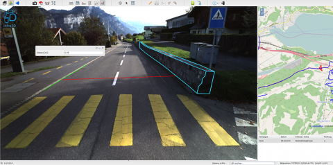
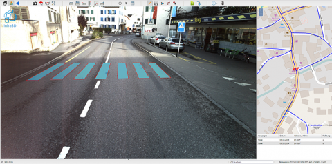
In the framework of infra3D Local Services, Glarus North could create a professional and highly precise infrastructure overview of its 200 km of road because the entire road network of the merged region was traversed by iNovtias’ digitalization vehicle.
The web-based service enables the image data base to be accessed at any time, in any department, direct from the work place. Numerous internal decisions can me made quicker on the basis of the detailed data. Using infra3D, external service providers and specialists can be consulted and contracted. Overall, management of the municipality’s road infrastructure is much more efficient with infra3D Local by comparison with normal measuring.
Individual configuration
The combination of infra3DLocal Services with a road management application offers the optimal foundation for value-maintenance management. Because the condition of the road, surveyed by infra3D and according to SIA & VSS standards, is mapped in the specialist application. On that basis, measures and financial plans can be developed, displayed and simulated.
Versatile use
The traffic and environment departments, as well as land use planning and structural engineering also use the infra3D-Service. While the traffic and environment departments can verify the general traffic concept, the land use and structural engineering departments carry out change analyses, distance measurements and much more.
The bottom line: cost and time efficiency
The infra3D Service enables the local authority of Glarus North to vastly increase the efficiency of visualization, condition assessment and management of their road infrastructure. In the area of visualization of the street space and condition assessment alone, they made a 30% cost saving by comparison with normal measuring. Further savings through its application and on-going use are yet to be quantified.
Simplification through the intuitive use of the infra3dLocal Service and streamlining in the areas of communication and cooperation will bring time savings.


